|
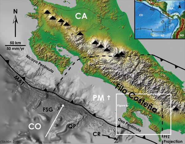
Figure 1. Hillshaded DEM showing morphologic characteristics of Costa Rica and the adjacent Cocos plate. Index map in upper, right corner. CA Caribbean plate; PM Panama microplate; CO Cocos Plate; NZ Nazca plate; NA North American plate; ND North Andes plate; CR Cocos Ridge; PFZ Panama Fracture Zone; MAT Middle America Trench; FSG Fisher Seamount Group; QP Quepos Plateau. Black triangles indicate active arc volcanoes. White arrows indicate plate motion vectors relative to a fixed CA. Long-dashed line represents estimated Panama microplate Caribbean plate boundary (i.e. central Costa Rica deformed belt). Short dashed line is northward projection of PFZ. Box shows the location of Figures 5. Maximum elevation is approximately 3800 m. Bathymetric data courtesy of GEOMAR.