Figure 11.19
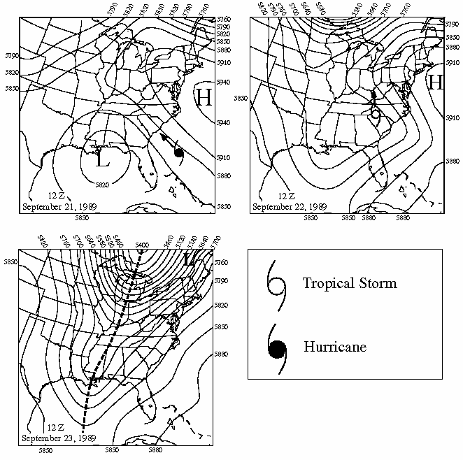
Figure 11.19. Steering of Hurricane Hugo, indicated by
500-mb charts (with 500-mb highs and lows labeled) at 12Z on
September 21-23, 1989. The position of Hugo at these times is
indicated using the official meteorological weather map symbols for
tropical storm and hurricane. Arrows show the subsequent movement
of the storm. Hugo's position as a dissipating tropical depression
is shown with an "L" at 12Z on September 23.