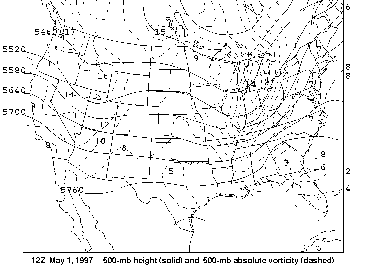
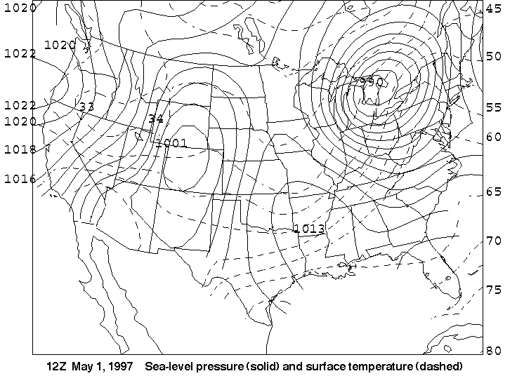
12Z May 1
- On the
surface map,
the surface low is now apparent. On the
500-mb height-vorticity map,
the trough is also now apparent (there is a definite
sag equatorward in the 500-mb heights over the Rockies). Do you think curvature has
become more or less important in generating relative vorticity associated
with the absolute vorticity maximum (of magnitude 16x10-5
sec-1 in eastern Idaho?
- Before we leave the
500-mb height-vorticity map, there's another
vorticity center taking shape over the West, but it's not marked yet!
Let's see if we can find it! What is the value of the isovort going
through northwestern Arizona? Is the value of the absolute
vorticity near the juncture of the Nevada, Utah and Arizona borders
larger or smaller than the value of this isovort? Thus, conclude whether the
region in northwestern Arizona that is bounded by the dashed line is a
relative maximum or relative minimum in vorticity. Keep this in mind
as we go to the next set of maps.
- Use the surface map to determine where
the largest temperature gradient is in Nevada and Utah: in the
northern or southern half of these states? Recall that cold
fronts are typically
placed at the leading edge of the cold air (that is, on the
warm side of the zone of largest
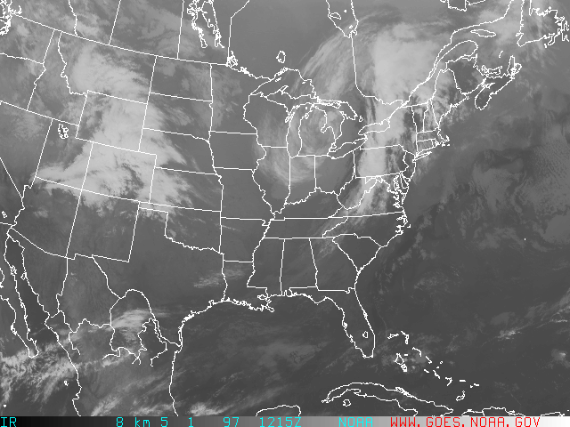
temperature gradient). Is the linear cloud formation on the
infrared satellite image at this time
consistent with where the cold front should be placed?